
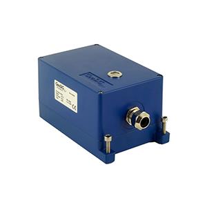
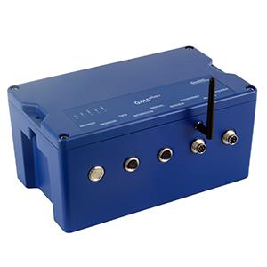
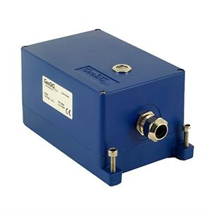


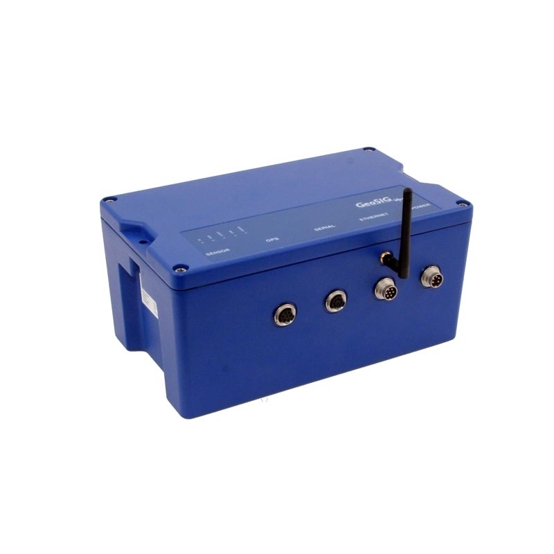
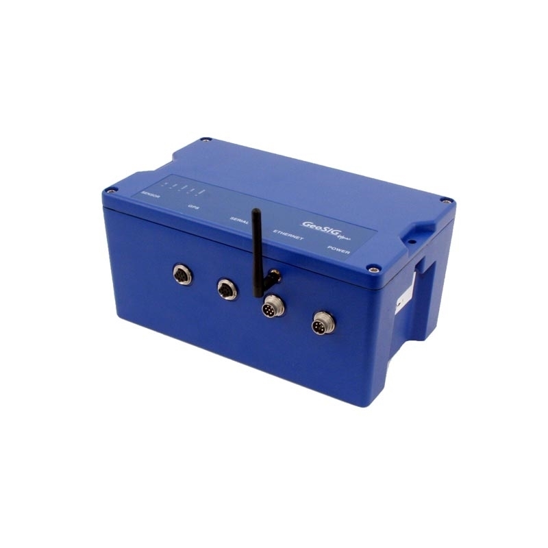
GeoSIG GMS NetQuakes Recorder
Key Features
- NetQuakes Recorder
- Internet Enabled, Optionally Wireless, Multifunctional Measuring System
- > 130 dB, 3 or 6 channels, up to 500 SPS
- Linux Operating System with On Board Processing and Evaluation
- Timing via NTP (Network Time Protocol), Optional GPS or 433 MHz Wi-Synch
- Enhanced Connectivity Options for GSM, GPRS, Satellite, Radio Telemetry or Landline Modem, Wired/Wireless Network
- Ring Buffer Continuous Recording
- Data Stream Output, Network Triggering
- Rugged, Water Resistant Cast Aluminium Housing with Levelling Base Plate for easy installation and Replacement
This is a project specific product which is not available for general sales.
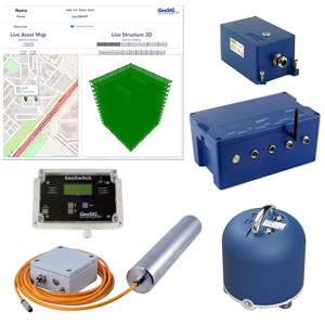
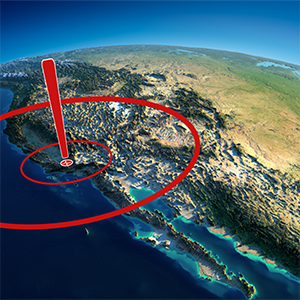
The GMS is the ground breaking second generation of the GeoSIG Measuring Systems with extended connectivity capability and flexibility. The unit is developed in close coordination with USGS and deployed in high quantities in North America establishing the NetQuakes system. It includes an Ethernet connection and optionally a 2.4 GHz Wi-Fi module to insure fast and reliable data transfer. Its design and efficiency makes it the first choice for any application requiring seismic instruments. With its optimized installation, operation and maintenance philosophy, the GMS offers the real possibility to implement such as high density arrays with total operating costs at a small fraction of conventional strong-motion seismograph networks.
The instrument’s software processes data in real time. If triggered by a seismic event, GMS calculates Peak Ground Acceleration (PGA), Peak Ground Velocity (PGV), Peak Ground Displacement (PGD) and Response Spectrum (RSA) at various frequencies of the event. GMS can report these parameters, which are related to the strength of shaking, to a data centre where a synopsis (such as a shakemap) for disaster management facilities can be generated in almost real time over the Internet. An event file is also recorded in the memory, which is sent out from the instrument and also securely accessible over the Internet.
GMS is self-contained and is equipped with an uninterruptible power-supply, which provides, excluding options, more than 24 hours emergency operation without external power. Since the battery and power management are critical components in applications, excessive care has been taken in the charger design. The GMS uses an intelligent “Real Time Clock” (RTC) with self-learning temperature compensation at a fraction of power and thus cost of a TCXO. The RTC is able to synchronize with GPS or NTP (Network Time Protocol based on Internet UTC timing) to provide high timing accuracy.
The instrument can be locally connected to a laptop through its ports for configuration, testing or data retrieval. The internal memory card can also be simply exchanged to retrieve the data. Several advanced communication options exist such as for connection over the Internet; it can utilize a list of servers where the communication is based on a simple but highly secure file exchange. Wired or Wireless Interconnected Network option enables the use of several units together in a time and trigger synchronised manner; wireless using the Wi-Fi and Wi-Synch options.
-
Applications
- - NetQuakes
- Seismic, Earthquake and Structural measuring and monitoring
- Urban Seismology
- High density monitoring networks
- Shake / Hazard mapping
- Disaster Management -
Set-up and Configuration
- Instrument setup is based on a configuration file in XML format. The configuration can be edited on site through the instrument console, exchanged by replacing the memory card or remotely from a server. Even if the configuration file can be manually edited at any time, a tool is provided to edit it securely.
-
Data Analysis
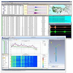
- The GeoDAS program provides basic data evaluation in the field. The instrument supplies data in miniSEED format. The GeoDAS Data Analysis Package covers the requirements of detailed laboratory analysis for most earthquake and civil engineering applications. Any other software package reading miniSEED can as well be used.
-
Sensor
- Various GeoSIG sensors as well as any other custom sensors can be housed internally or connected externally to the unit. In case of internal sensor, the levelling is done on the base plate of the GMS via three levelling screws. The base plate is mounted using a single bolt during installation.
-
Digitizer
- Channels:
- 3 or 6
- A/D conversion:
- 24 bit delta-sigma converters running in parallel
- Dynamic range:
- >130 dB
- Sampling rate:
- Can be any integer division of:
3 chn: 500 SPS (ie. 500, 250, 167, 125, 100, ..., 1)
6 chn: 200 SPS (ie. 200, 100, 67, 50, 40, …, 1)
More options are available depending on the selected maximum rate. - Bandwidth:
- 40% of sampling rate
- Anti Aliasing Filter:
- FIR (finite impulse response)
-
Triggering
- Several “Trigger set”s can be defined in the instrument with each one freely defined regarding the source of trigger, trigger processing and selected channels for storage. For each trigger a “Minimum exceedance duration” can be defined to insure that the unit will not trigger on spikes.
-
Trigger Filter
- High Pass Filter:
- None, 0.1, 0.2, 0.5, 1 or 2 Hz*
- Low pass filter:
- None, 2, 5, 10 or 20 Hz*
- Band pass filter response:
- 2 poles on each side* (40 dB / decade)
- *Any other value is freely useable, as long as does not lead to data loss.
-
Level Triggering
- Range:
- 0.01 to 100 % of full scale
- User adjustable threshold.*
-
STA/LTA Triggering
- STA period:
- 0.01 to 100 seconds
- LTA period:
- 0.01 to 100 seconds
- STA/LTA-Ratio:
- 1 to 100 ratio
-
Event Recording
- Pre-event memory:
- 1 to 100 seconds
- Post-event duration:
- 1 to 1000 seconds
-
Event Summary
- Including
- PGA, PGV, PGD, RSA
- Transmission delay:
- User defined from trigger time
-
Ring Buffer
- Usage:
- User can request backward from console or remotely from server for portion of the buffer as start time/date and duration.
- Method:
- Ringbuffer files with configurable duration.
-
Data Stream
- Total Data Time Lag:
- 0 ms, full correction included
- Protocol:
- GSBU, optionally Seedlink, Earthworm
-
Storage Memory
- Size and Type:
- 2 GByte Removable Compact Flash Card higher capacity up to 32 GByte on request FAT32 formatted
- Management:
- Intelligent management of memory card capacity using policies as per file type and ring buffer capacity specification.
- Recording format:
- miniSEED
- Estimated Capacity:
- 50 SPS: 18 Mb / day
100 SPS: 36 Mb / day
200 SPS: 72 Mb / day
500 SPS: 180 Mb / day
Since the data is compressed, capacity depends on the context of the data. -
CPU
- Processor:
- Freescale ColdFire
- RAM:
- 32 MByte
- Flash:
- 16 MByte
- Operating System:
- uCLinux
-
Time Base
- Standard accuracy:
- 20 ppm (10 min/year @ -10 to +50 °C), higher accuracy optional
- Accuracy after learn:
- 0.5 ppm (16 s/year or 2 ms/h)
- Accuracy with NTP:
- ±10 ms accuracy, assuming reasonable access to NTP-servers
- External time interfaces:
- GPS (optional) , Interconnection (optional)
-
Power Supply
- Input voltage:
- 90 - 260 VAC / 50 – 60 Hz
- Type
- Switched external power supply
- Internal battery:
- Rechargeable, 12 VDC, 7.2 Ah lead battery
- Power consumption:
- 130 mA @ 12 VDC
- Autonomy:
- > 1 day
- Battery charger:
- Temperature compensated with battery fault detection.
-
Indicators
- Green
- AC Power present LED
- Green
- Run/Stop LED
- Yellow:
- Event/Memory LED
- Blue:
- Network link/Traffic LED
- Red:
- Warning/Error LED
-
Communication
- Configuration, Data Retrieval:
- via ETHERNET, SERIAL or CONSOLE, or directly from removable memory card.
- Network requirements:
- Fixed or Dynamic IP on Ethernet LAN and/or internet connection with Ethernet interface. Wifi network with WEP or WPA security parameters for instrument configuration.
- Security:
- GeoDAS proprietary protocol checksum and software handshaking
- Serial ports:
- 2 ports, 3 ports optional
- Baud rates:
- Console: 19200 bauds
Stream: 38400, 57600, 115200 bauds
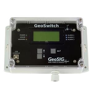
Alarm / Seismic Switch / Warning Option - Alarms:
- 4 independent relay contacts for trigger alarm or error
- Alarm levels:
- Based on event triggers(NO or NC selectable during order)
- Relay Hold-On:
- 1 to 60 seconds(User programmable)
- Capacity:
- The contacts are suitable for a low voltage control. In case large load must be switched then external relays should be implemented.
- Max voltage:
- 125VAC / 125 VDC
- Max Current:
- 250 mA
-
Interconnected Network Option
- Wired or Wireless (Wi-Synch) time synchronisation (Common Time) among several units are optional. Trigger synchronisation (Common Trigger) is handled over the Wired/Wireless Ethernet.
-
Modem
- Internal or external modems of different types are available optionally.
- Self Test
- Permanent self monitoring of hardware and software components without affecting their normal operation. Periodical state of health report based on comprehensive test of instrument. Period can be set in minutes and/or hours and/or days. Periodical sensor test. Period can be set in days.
-
Enviroment
- Operational temperature:
- -20 to +70 °C
- Storage temperature:
- -40 to +85 °C
- Humidity:
- 0 to 100 % RH (non condensing) housing
- Type:
- Cast aluminium housing
- Size:
- 296 x 175 x 140 mm (W x D x H)
- Size with base plate:
- 296 x 225 x 156 mm (W x D x H)
- Weight:
- 4.7 kg (optional < 4 kg) excl. sensor, battery, etc. 0.3 kg internal sensor, 2.6 kg battery, 1.3 kg base plate, ask for other options
- Protection:
- IP65 (NEMA 12) , optionally IP67
- Mounting:
- Base plate with single bolt, surface mount. When base plate levelled and fixed, GMS can be replaced without re-levelling.
-
**Specifications subject to change without notice