


GeoWatch Issue 43
19/10/2009
|
Table of contents
|
||||
| Sakhalin II project – Monitoring and Rapid Response System | ||||
|
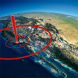
Sakhalin is a large elongated island stretching over more than 900 km from North to South in the Russian Far East. Sakhalin is known for its seismic hazards with a high probability of occurrence and a high degree of uncertainty.
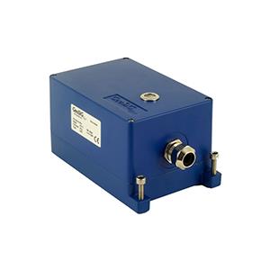
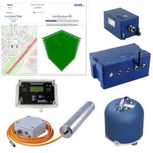
Sakhalin Energy Investment Company Ltd. (Sakhalin Energy) is the operator of the Sakhalin-II project. Sakhalin Energy has a production sharing agreement with the Russian Federation. Sakhalin-II is the world’s biggest project of integrating oil and gas, consisting of three offshore oil production platforms, 300 km offshore and more than 800 km onshore oil and gas pipelines, an onshore processing facility, an oil export terminal and Russia’s first liquefied natural gas (LNG) plant. Aiming to be the new energy source for the entire Asia-Pacific area, Sakhalin Energy had to implement an investment strategy regarding the safety due to the seismic activity in the region. Sakhalin Energy therefore sought for comprehensive solutions in relation to the routeing of pipelines, being able to safely deliver the energy source to the identified customer bases. These solutions were not limited to safety measures against direct effects of the seismic hazards but also indirect ones, such as landslides, avalanches, mudflows, subsidence and similar earth movements associated with seismic activity. The onshore pipeline solution along the Sakhalin Island was impossible to achieve without passing through identified fault locations where extra protection was needed. Special safety measures, in case of an earthquake, were installed in the form of thicker walled pipes, special trench profiles which allow pipe movement plus block valves on either side of most fault crossings. The offshore pipelines do not cross any active geological faults and therefore no special safety measures were required offshore. In addition to the constructional safety measures, Sakhalin Energy implemented a comprehensive monitoring and management infrastructure called Pipeline Operating Management System (POMS), featuring state-of-the-art monitoring equipment, remote operated block valves, as well as data collection and interpretation components to achieve a rapid and prompt response to any potential damage. GeoSIG supplied the Seismic Monitoring and Rapid Response System, that, in case of an earthquake, measures the local accelerations, generates a detailed shakemap, compares the accelerations with the design limits of the facilities and triggers alarms accordingly. The supplied instrumentation consists of field stations with borehole accelerometers and intelligent seismic recorders with associated peripheral equipment, designed to work under the harsh environmental conditions. In addition a central cabinet for the system was supplied, featuring hardware and specialised software to facilitate full configuration, operation and interfacing within Sakhalin Energy's local and remote systems. GeoSIG’s Shakemap software application has been extensively customised to meet the specific requirements of Sakhalin Energy, including the addition of an online interactive web-based interface. Utilising the GeoSIG system, Sakhalin Energy is able to very quickly analyse the effect of an earthquake and determine if it is safe to continue operating or a shut down for inspection has to be initialised. This system is also an enormous help for the company in estimating where to focus the inspection efforts and possible emergency response on. The location of a potential pipeline impairment may be hard to define without the information that is generated with the sensors and shakemap. |
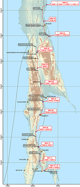
Figure 1. Overview of the and the Measuring Points |
|||
|
Request |
Product / Solution |
|---|---|
|
13 Sensors (39 Channels) |
AC-43-DH Downhole Triaxial Force Balance Accelerometer |
|
13 Recorders |
GMS-18 |
|
13 Peripheral Units |
GMS-GPS, DH-TUBE, etc |
|
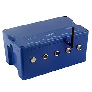
1 Data Acquisition & Processing Centre |
RACK-1, Computer, GeoDAS, ShakeMap |
| 1) The field stations give hard-wired alarm contacts to the POMS. The alarms are set at 25 and 75% of the Strength Level Earthquake (SLE) and will alert the Pipeline operator instantaneously in case of a shake in excess of 25 or 75% SLE. The field stations are also connected to the central Seismic Network Processor trough the existing Process Control Domain. 2) The Shakemap application is available to all Sakhalin Energy employees via the company’s intranet. Pipeline support staff and Geomatics engineers can all analyse the earthquake information and advise how to respond. 3) All Sakhalin Energy employees can also see the three signals from each field station on a map of the island in a graphical format using OSIsoft-PI Processbook. 4) Sakhalin Energy Geomatics engineers will download the calibrated shakemap of measured and estimated ground motion from the Shakemap application and superimpose this over the map of the island with all Geohazards (landslides, fault crossings, etc). They will then analyse the combined data and produce a survey plan to determine if Geohazards have changed their state. |
Figure 3. System topology |
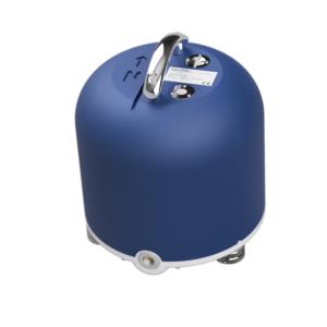
Our Accelerometer used in NPP-Instrumentations, the AC-23-NPP, has successfully passed radiation testing, conducted by STERIS Isomedix Services in the
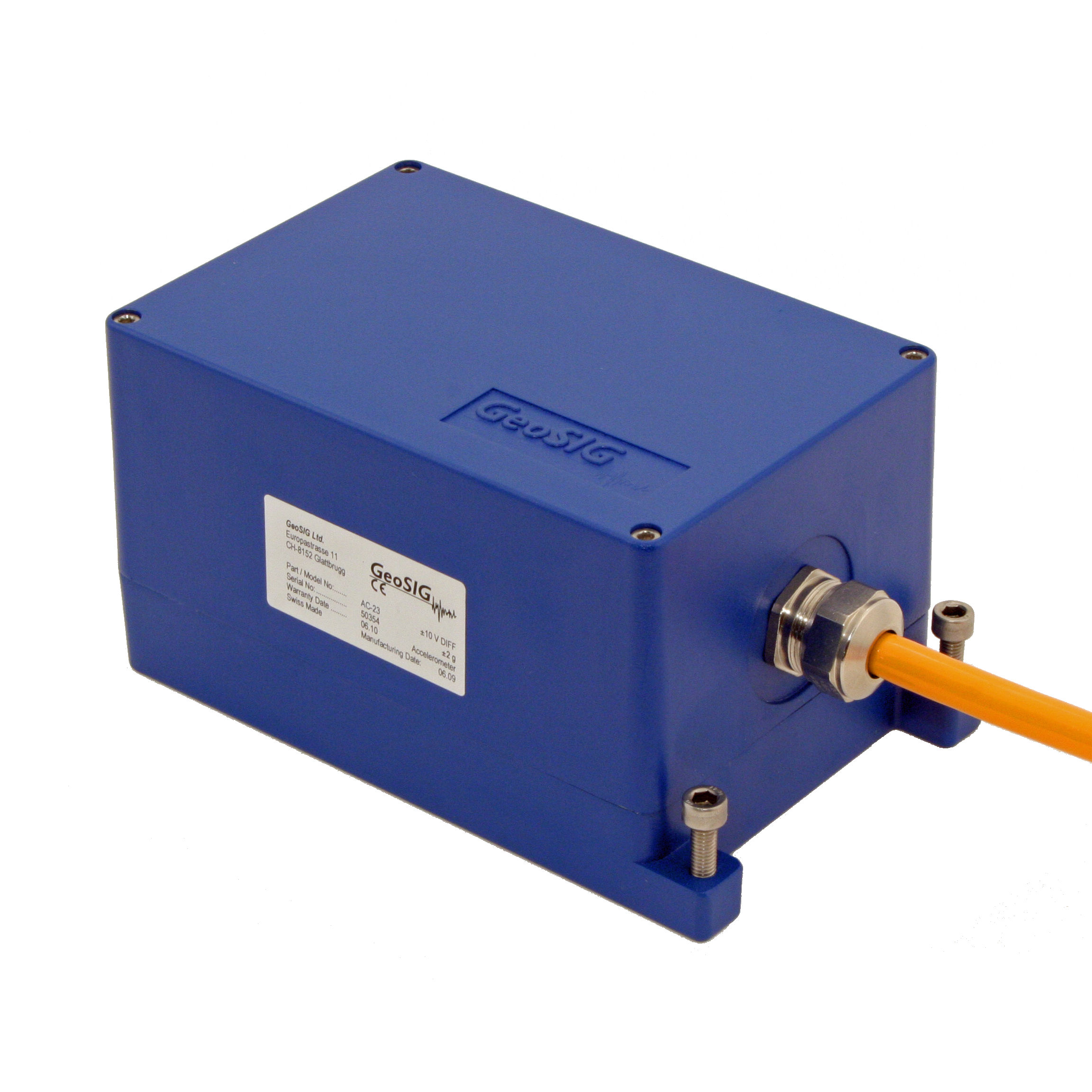
Figure 4. AC-23
|
The Sensor worked properly after being exposed to radioactive radiation for over 11 hours. The AC-23-NPP is a modified version of our standard AC-23 Accelerometer.
|
|
GeoSIG is going to exhibit at this year’s AGU Fall Meeting. The meeting is taking place from 14 to 18 December, the exhibition from 15 to 18, in
More information about the AGU Fall Meeting, a detailed floorplan and all other required information are available on the official homepage of the AGU Fall Meeting 2009 under http://www.agu.org/meetings/fm09.
|
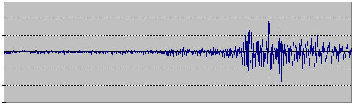
Our Seismic Switch SSW-43 recorded the recent earthquake east of
Experts don’t rule out a coherence between the more than 130 earthquakes which happened so far in this at the moment highly active seismological zone.

|
This earthquake in the east of the
|
These earthquakes showed us once more the devastating effect nature can have on humans and how important Rapid Response Systems (as reported in our previous GeoWatch 40) would be for the rescuing missions.
|
||
| Figure 5. Location and local intensity of the earthquake (data provided by CWB, |
Figure 6. Earthquake recordings |
This summer 4 new apprentices joined the GeoSIG family and started their apprenticeship, Yannick Hilpert and Christoph Weber as electronic technician, Kevin Siegrist as commercial administration employee and Iliaz Gashi as caretaker.
Apprenticeships take 3 or 4 years, depending on the job selected, and give the apprentices a good basic knowledge for their careers. At the end of an apprenticeship an exam needs to be passed to receive graduation.
|
The apprenticeship is the most common education in
|
We warmly welcome our 4 new apprentices and wish them all the best on their way into the working world.
|
GeoSIG Ltd • Ahornweg 5A • 5504 Othmarsingen • Switzerland
Tel.: +41 44 810 21 50 • Fax: +41 44 810 23 50 • Email: marketing@geosig.com • www.GeoSIG.com